


Kornati National Park
Nautical paradise for recreational sailors and sea lovers
Kornati excursions
If you want to explore Kornati, the pearl of the Adriatic, the best option is to make a Kornati tour by boat. Choose the best tour according to your needs and enjoy in group tour with a larger number of people and a predetermined travel schedule, or have a private tour, which is fully adapted to you.

Kornati excursions – group tours
Group tours are organized with boats that can accommodate from 70 to 180 people. Choose one of the offered itineraries that suits you best and enjoy the beautiful locations in the Kornati National Park
Zadar & Bibinje: Kornati National Park tour with Fažanka boat
Zadar: Kornati National Park tour with Vagabundo boat

Full-day trip to the Telašćica Nature Park and Lojena beach. Visit to the cliffs and Salt lake Mir in Telašćica.

Full-day trip to the Lojena beach and Telašćica Nature Park. Visit to the cliffs and Salt lake Mir in Telašćica.
Zadar: Kornati National Park tour with Sveti Šime II boat
Zadar: Kornati National Park tour with Plava Laguna boat

Full-day trip to the Lojena beach and Telašćica Nature Park. Visit to the cliffs and Salt lake Mir in Telašćica.

Full-day trip to the islands of Kornat and Mana. Lunch in the captain’s house at Suha Punta bay. Cliff jumping, snorkeling….
Zadar: Kornati National Park tour with Eufemija boat
Zadar: Kornati National Park tour with Leut boat

Full-day trip to the island of Mana, Lojena beach and Kukljica. Snorkeling, cliff jumping…

Full-day trip to Kornati National Park and Kukljica. Swimming on the private beach on the island of Lavdara.
Biograd na Moru: Kornati National Park tour with Sveti Šime I boat
Vodice: Kornati National Park tour with Ina boat

Full-day trip to the Katina island and Telašćica Nature Park. Visit to the cliffs and Salt lake Mir in Telašćica.

Full-day trip to the Kornati National Park and Telašćica Nature Park. Visit to the cliffs and Salt lake Mir in Telašćica.
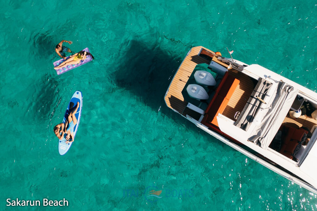
Zadar: Kornati National Park & Sakarun Beach tour with speedboat

Full-day trip to the island of Mana, Lojena beach and Sakarun beach. Snorkeling, cliff jumping…
Other Group Tours
In addition to Kornati tours, explore a selection of our other carefully chosen group boat excursions, offering diverse experiences at sea.
Zadar: Full-Day Sakarun Beach & Snorkel Adventure Tour
Zadar: Half-Day Speedboat Tour with Food, Olive Oil & Wine Tasting

Visit Sakarun Beach and sea caves. Blue Lagoon and Dragon Eye bay. Swimming and snorkeling stops.

Speedboat ride through the Zadar archipelago. Local food, olive oil and wine tasting. Short island stops.
Zadar: Sunset & Night Cruise with Unlimited Sparkling Wine
Zadar: Sunset Cruise on a Luxury Boat

Evening cruise along Zadar’s coast. Sunset and night views from the sea. Relaxed atmosphere on board.

Luxury boat sunset cruise along Zadar’s coast. Panoramic sea views. Relaxed evening atmosphere.

Kornati excursions – private tours
Choose our Kornati private tour and enjoy this unique archipelago. You can make your own itinerary, according to your wishes and we will do our best to make this trip memorable. Kornati private tours leave everyone breathless with a sense of fulfillment. Spend an unforgettable time exploring hidden bays, secluded beaches, and a rich underwater world on a fully guided Kornati day trip. Join us on an exciting speedboat ride with friends or a family one-day trip.
Other private tours
Alongside private Kornati tours, explore a wider selection of private boat experiences at carefully chosen locations beyond the Kornati Islands. These tours offer a more flexible and personalized way to discover different coastal areas, hidden bays and scenic routes, all at your own pace and in complete privacy.
The magical beach of Sakarun
E-Foil Adventure in National Park Kornati
The charming Zadar sunset

You don’t have to go to the Caribbean to feel the softness of the white sand beneath your feet and swim through clear turquoise sea. Come to Sakarun beach and experience the magic of relaxation on one of the most beautiful beaches in Croatia.

Experience the thrill of flying above the crystal-clear sea surrounded by the breathtaking Kornati islands. Glide effortlessly on your e-foil and discover hidden bays, untouched nature, and the true freedom of the Adriatic.

Sail into the golden evening and watch the sun melt into the Adriatic horizon. Enjoy delicious local snacks, a glass of wine, and the soft sound of the sea — a truly romantic experience under the colors of the charming Zadar sunset.
KORNATI RESTAURANTS
Sailing through the beautiful labyrinth of the Kornati is not complete without pleasures on a plate. Restaurants on the Kornati islands offer a unique experience of tradition, local history, and a modern approach to gastronomy. First-class fish is caught in the morning of the same day when it is prepared for guests and is exclusively served there. Here, guests are offered specialties and drinks that are not expected on isolated islands, such as the top champagnes, the best cigars, or the world’s most expensive rums.
KORNATI ACCOMMODATION
Accommodation in Kornati National Park is provided only by tourist agencies and private renters that are registered to perform such activities in the archipelago. Looking for an ideal Kornati accommodation? Take a look at our offer to find your spot and enjoy the unique beauty of the area! Book from reliable renters and spend a great vacation in Kornati.
Kornati islands-Raw and beautiful
Kornati islands are the densest archipelago in the Mediterranean Sea consisting of 140 islands, islets, and reefs. They’re located in the northern part of Dalmatia, between Zadar and Šibenik. The name Kornati came from the plural form of the largest island called Kornat, but they’re also known as Stomorski islands. There are no permanent residents on Kornati islands across a sea area of about 320km². The Kornati islands represent a true paradise for boaters, divers, and all those who love to enjoy the charms of intact nature. With a mix of land and sea activities, the unique limestone-karst terrain, and the underwater ecosystem, the way to experience the area largely depends on the kind of the Kornati islands tour.
Kornati National Park
For its exceptional natural beauty and interesting geomorphology a larger part of the Kornati archipelago has been protected as a national park since 1980. Kornati National Park includes 89 uninhabited islands, islets, and reefs, spread across an area of 217 km². Comprised of both land and sea, the national park Kornati is famous for its vertical cliffs and the crystal-clear sea. Some of the most impressive cliffs go as high as 80 meters outlining the islands and facing the open sea allowing unforgettable views. Alongside its preserved nature, Kornati is a wild destination for sailing and a paradise for snorkeling. Many straits between the islands make perfect spots to drop anchor and swim in the crystal clear sea. Besides nautical tourism, Kornati National Park is a true divers’ heaven well known for its rich underwater world counting 850 animal species, 353 species of algae, and 3 species of underwater flower plants.

Kornati beaches
The appearance of the Kornati was influenced by many factors, shaped by the strong wind, the sun, and the sparse vegetation. Speaking of swimming spots, Kornati beaches are pristine and relatively deserted. Thanks to the seclusion of the archipelago, beaches are rarely crowded. With a mix of sandy beaches on tranquil bays surrounded by dramatic cliffs, everyone can find their own favorite.


How to get Kornati ticket?
Every visitor to Kornati National Park should have a valid ticket for each day of their stay in the park, so make sure to buy a Kornati ticket prior to your arrival. The most convenient option is to book a one-day tour which includes a Kornati ticket. Ticket prices for Kornati National Park are charged per boat and usually depend on the vessel size, the number of days the boat is in the park, and the month. Private tours to the Kornati islands are organized and performed by registered shipowners and usually depart from Zadar, Šibenik, or Murter.
Weather – Kornati
According to previous research, the Kornati Islands are meteorologically located between two different areas: the northern Adriatic, which in spring and autumn is more influenced by Genoese cyclones, and the southern Adriatic, which is more permanently affected by the subtropical belt of high atmospheric pressure in summer. Due to the relatively small area and the low altitude, the climate is almost completely uniform throughout the Kornati area. Due to the sparse terrestrial vegetation, dew is usually abundant and somewhat replaces the rain. According to Köppen’s division, the Kornati have an olive climate, Csa (moderately warm rainy climate with dry and hot summer; the most rain in autumn).
The air temperature fluctuates from an average of 8°C in February to an average of 25°C in July and August, i.e. an annual average of around 16°C. The highest recorded maximum air temperature at the weather station V. Sestrica in Kornati was 36.4°C, and the lowest minimum was -3.8°C. Even 270 days a year it is warmer than 10°C. There are an average of 4.2 cold days (temperature below 0°C) per year. Warm days (highest air temperature at least 25°C) last 90 days a year (starting in May and lasting until October), while there are about 40 hot days (highest temperature at least 30°C), and they last from May to September (most of them are in August = 16.9).
Cloud cover is small: in the cloudiest winter months, clouds cover on average only slightly more than half of the sky, and in summer not even a quarter. August has an average of 2 cloudy days and as many as 22 clear days (in the whole year there are twice as many clear days as cloudy days, 151:74). However, it is interesting that almost every cloudy day it rains. The main rain maximum is in October (in other parts of Croatia it is November).
The most common wind in Kornati is bora (19.4%), and the strongest is southerly. In summer, the mistral prevails. In principle, the movement of air masses from the sea to the land dominates. Winds of strength 1 to 3 of Beaufort prevail in 70% of cases (from a light breeze to a weak wind). Strong winds (6 or more Beauforts) blow about 37 days a year, with the fact that even in December, when they are most frequent, there are no more than 5 days. There are 5.8 days of stormy wind a year, most often in December. Silence occurs in 15.4% of cases per year.
Kornati National Park
Nautical paradise for recreational sailors and sea lovers
Kornati excursions
If you want to explore Kornati, the pearl of the Adriatic, the best option is to make a Kornati tour by boat. Choose the best tour according to your needs and enjoy in group tour with a larger number of people and a predetermined travel schedule, or have a private tour, which is fully adapted to you.
Kornati excursions – group tours
Group tours are organized with boats that can accommodate from 70 to 180 people. Choose one of the offered itineraries that suits you best and enjoy the beautiful locations in the Kornati National Park
Zadar & Bibinje: Kornati National Park tour with Fažanka boat
Full-day trip to the Telašćica Nature Park and Lojena beach. Visit to the cliffs and Salt lake Mir in Telašćica.
Zadar: Kornati National Park tour with Vagabundo boat
Full-day trip to the Telašćica Nature Park and Lojena beach. Visit to the cliffs and Salt lake Mir in Telašćica.
Zadar: Kornati National Park tour with Sveti Šime II boat
Full-day trip to the Lojena beach and Telašćica Nature Park. Visit to the cliffs and Salt lake Mir in Telašćica.
Zadar: Kornati National Park tour with Plava Laguna boat
Full-day trip to the islands of Kornat and Mana. Lunch in the captain’s house at Suha Punta bay. Cliff jumping, snorkeling….
Zadar: Kornati National Park tour with Eufemija boat
Full-day trip to the island of Mana, Lojena beach and Kukljica. Snorkeling, cliff jumping…
Zadar: Kornati National Park tour with Leut boat
Full-day trip to Kornati National Park and Kukljica. Swimming on the private beach on the island of Lavdara.
Biograd na Moru: Kornati National Park tour with Sveti Šime I boat
Full-day trip to the Katina island and Telašćica Nature Park. Visit to the cliffs and Salt lake Mir in Telašćica.
Vodice: Kornati National Park tour with Ina boat
Full-day trip to the Kornati National Park and Telašćica Nature Park. Visit to the cliffs and Salt lake Mir in Telašćica.
Zadar: Kornati National Park & Sakarun Beach tour with speedboat
Full-day trip to the island of Mana, Lojena beach and Sakarun beach. Snorkeling, cliff jumping…
Other Group Tours
In addition to Kornati tours, explore a selection of our other carefully chosen group boat excursions, offering diverse experiences at sea.
Zadar: Full-Day Sakarun Beach & Snorkel Adventure Tour
Visit Sakarun Beach and sea caves. Blue Lagoon and Dragon Eye bay. Swimming and snorkeling stops.
Zadar: Half-Day Speedboat Tour with Food, Olive Oil & Wine Tasting

Speedboat ride through the Zadar archipelago. Local food, olive oil and wine tasting. Short island stops.
Zadar: Sunset & Night Cruise with Unlimited Sparkling Wine

Evening cruise along Zadar’s coast. Sunset and night views from the sea. Relaxed atmosphere on board.
Zadar: Sunset Cruise on a Luxury Boat

Luxury boat sunset cruise along Zadar’s coast. Panoramic sea views. Relaxed evening atmosphere.
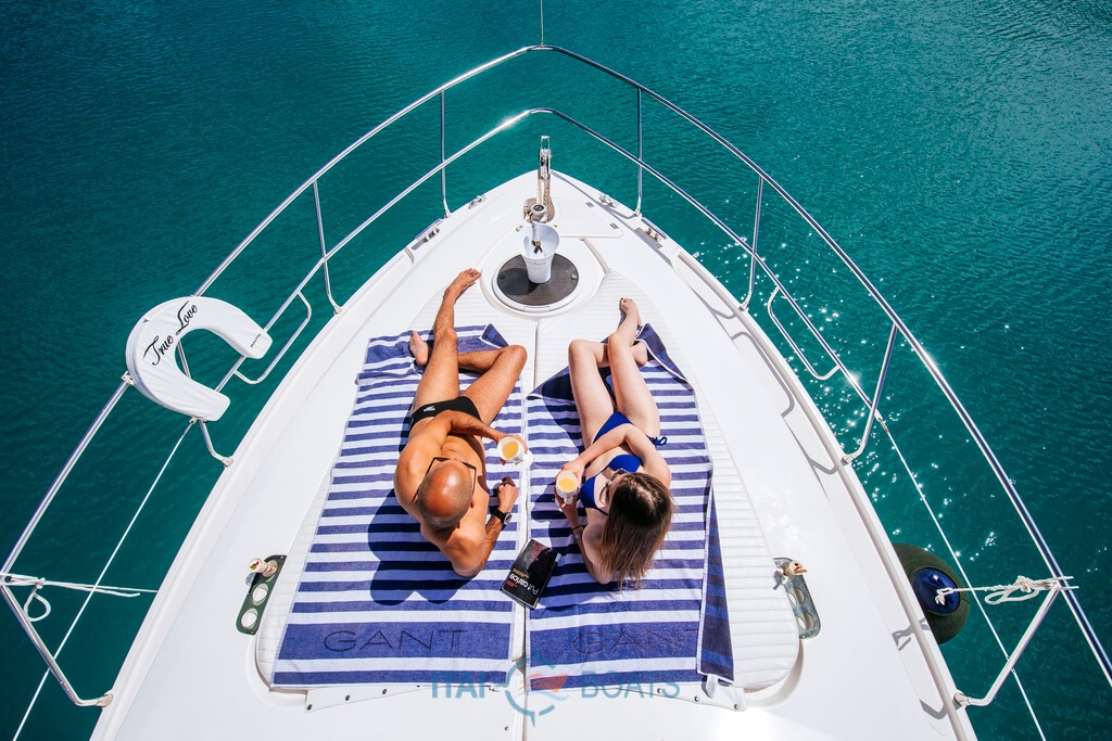
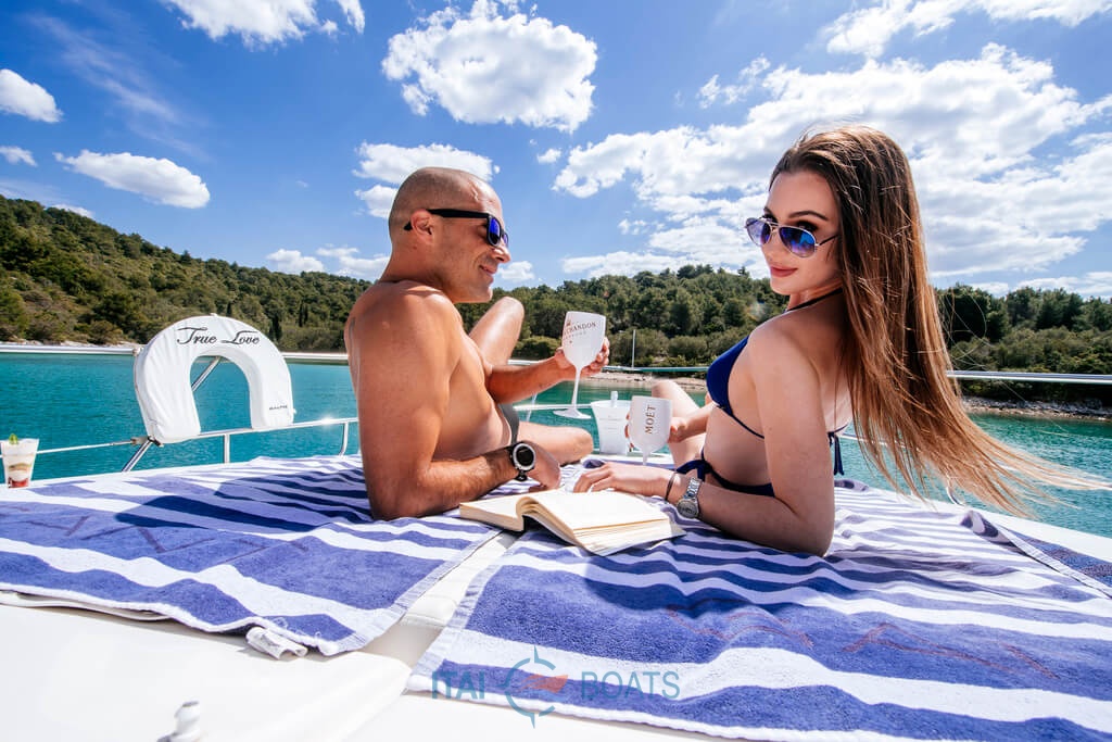
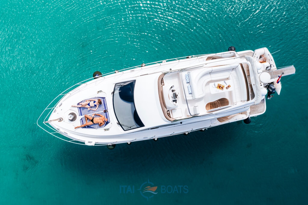
Kornati excursions – private tours
Choose our Kornati private tour and enjoy this unique archipelago. You can make your own itinerary, according to your wishes and we will do our best to make this trip memorable. Kornati private tours leave everyone breathless with a sense of fulfillment. Spend an unforgettable time exploring hidden bays, secluded beaches, and a rich underwater world on a fully guided Kornati day trip. Join us on an exciting speedboat ride with friends or a family one-day trip.


")
Other private tours
Alongside private Kornati tours, explore a wider selection of private boat experiences at carefully chosen locations beyond the Kornati Islands. These tours offer a more flexible and personalized way to discover different coastal areas, hidden bays and scenic routes, all at your own pace and in complete privacy.
The magical beach of Sakarun
You don’t have to go to the Caribbean to feel the softness of the white sand beneath your feet and swim through clear turquoise sea. Come to Sakarun beach and experience the magic of relaxation on one of the most beautiful beaches in Croatia.
E-Foil Adventure in National Park Kornati

Experience the thrill of flying above the crystal-clear sea surrounded by the breathtaking Kornati islands. Glide effortlessly on your e-foil and discover hidden bays, untouched nature, and the true freedom of the Adriatic.
The charming Zadar sunset
 (2) (1) (1)")
Sail into the golden evening and watch the sun melt into the Adriatic horizon. Enjoy delicious local snacks, a glass of wine, and the soft sound of the sea — a truly romantic experience under the colors of the charming Zadar sunset.
Kornati restaurants
Sailing through the beautiful labyrinth of the Kornati is not complete without pleasures on a plate. Restaurants on the Kornati islands offer a unique experience of tradition, local history, and a modern approach to gastronomy. First-class fish is caught in the morning of the same day when it is prepared for guests and is exclusively served there. Here, guests are offered specialties and drinks that are not expected on isolated islands, such as the top champagnes, the best cigars, or the world’s most expensive rums.
Kornati
Accommodation
Accommodation in Kornati National Park is provided only by tourist agencies and private renters that are registered to perform such activities in the archipelago. Looking for an ideal Kornati accommodation? Take a look at our offer to find your spot and enjoy the unique beauty of the area! Book from reliable renters and spend a great vacation in Kornati.
 (1)")
Kornati islands- Raw and beautiful
Kornati islands are the densest archipelago in the Mediterranean Sea consisting of 140 islands, islets, and reefs. They’re located in the northern part of Dalmatia, between Zadar and Šibenik. The name Kornati came from the plural form of the largest island called Kornat, but they’re also known as Stomorski islands. There are no permanent residents on Kornati islands across a sea area of about 320km². The Kornati islands represent a true paradise for boaters, divers, and all those who love to enjoy the charms of intact nature. With a mix of land and sea activities, the unique limestone-karst terrain, and the underwater ecosystem, the way to experience the area largely depends on the kind of the Kornati islands tour.

Kornati National Park
For its exceptional natural beauty and interesting geomorphology a larger part of the Kornati archipelago has been protected as a national park since 1980. Kornati National Park includes 89 uninhabited islands, islets, and reefs, spread across an area of 217 km². Comprised of both land and sea, the national park Kornati is famous for its vertical cliffs and the crystal-clear sea. Some of the most impressive cliffs go as high as 80 meters outlining the islands and facing the open sea allowing unforgettable views. Alongside its preserved nature, Kornati is a wild destination for sailing and a paradise for snorkeling. Many straits between the islands make perfect spots to drop anchor and swim in the crystal clear sea. Besides nautical tourism, Kornati National Park is a true divers’ heaven well known for its rich underwater world counting 850 animal species, 353 species of algae, and 3 species of underwater flower plants.
Kornati beaches
The appearance of the Kornati was influenced by many factors, shaped by the strong wind, the sun, and the sparse vegetation. Speaking of swimming spots, Kornati beaches are pristine and relatively deserted. Thanks to the seclusion of the archipelago, beaches are rarely crowded. With a mix of sandy beaches on tranquil bays surrounded by dramatic cliffs, everyone can find their own favorite.
Weather – Kornati
According to previous research, the Kornati Islands are meteorologically located between two different areas: the northern Adriatic, which in spring and autumn is more influenced by Genoese cyclones, and the southern Adriatic, which is more permanently affected by the subtropical belt of high atmospheric pressure in summer. Due to the relatively small area and the low altitude, the climate is almost completely uniform throughout the Kornati area. Due to the sparse terrestrial vegetation, dew is usually abundant and somewhat replaces the rain. According to Köppen’s division, the Kornati have an olive climate, Csa (moderately warm rainy climate with dry and hot summer; the most rain in autumn).
The air temperature fluctuates from an average of 8°C in February to an average of 25°C in July and August, i.e. an annual average of around 16°C. The highest recorded maximum air temperature at the weather station V. Sestrica in Kornati was 36.4°C, and the lowest minimum was -3.8°C. Even 270 days a year it is warmer than 10°C. There are an average of 4.2 cold days (temperature below 0°C) per year. Warm days (highest air temperature at least 25°C) last 90 days a year (starting in May and lasting until October), while there are about 40 hot days (highest temperature at least 30°C), and they last from May to September (most of them are in August = 16.9).
Cloud cover is small: in the cloudiest winter months, clouds cover on average only slightly more than half of the sky, and in summer not even a quarter. August has an average of 2 cloudy days and as many as 22 clear days (in the whole year there are twice as many clear days as cloudy days, 151:74). However, it is interesting that almost every cloudy day it rains. The main rain maximum is in October (in other parts of Croatia it is November).
The most common wind in Kornati is bora (19.4%), and the strongest is southerly. In summer, the mistral prevails. In principle, the movement of air masses from the sea to the land dominates. Winds of strength 1 to 3 of Beaufort prevail in 70% of cases (from a light breeze to a weak wind). Strong winds (6 or more Beauforts) blow about 37 days a year, with the fact that even in December, when they are most frequent, there are no more than 5 days. There are 5.8 days of stormy wind a year, most often in December. Silence occurs in 15.4% of cases per year.
How to get Kornati ticket?
Every visitor to Kornati National Park should have a valid ticket for each day of their stay in the park, so make sure to buy a Kornati ticket prior to your arrival. The most convenient option is to book a one-day tour which includes a Kornati ticket. Ticket prices for Kornati National Park are charged per boat and usually depend on the vessel size, the number of days the boat is in the park, and the month. Private tours to the Kornati islands are organized and performed by registered shipowners and usually depart from Zadar, Šibenik, or Murter.
Kornati park: Good to know before you go
- Kornati National park is suitable for island hopping with lots of seaside activities
- It’s an ideal location for recreational sailors and divers
- The park is open to visitors throughout the whole year
-
Swimming is allowed in the whole of the Kornati National Park, except in the zones of strict protection
-
Sailing is allowed in the whole of the Kornati National Park, except in the zones of strict protection
Plitvice Lakes National Park & Krka National Park
Discover the breathtaking beauty of Croatia’s inland wonders with our excursions to Plitvice Lakes National Park and Krka National Park. Both parks offer unforgettable experiences of pristine nature, cascading waterfalls, and lush greenery—perfect for a day of adventure beyond the Adriatic coast. Whether you choose the world-famous Plitvice Lakes, with its chain of 16 crystal-clear lakes and countless waterfalls, or the stunning Krka Waterfalls, famous for their dramatic cascades and scenic walking trails, you’re guaranteed a memorable journey into Croatia’s most iconic landscapes. Join a group tour or choose a private trip tailored to your preferences, and experience the best of Croatia’s national treasures.
Plitvice Lakes National Park

Discover the stunning beauty of Plitvice Lakes, where 16 interconnected lakes and cascading waterfalls create one of Europe’s most enchanting natural wonders. Perfect for nature lovers and adventure seekers alike.
Krka National Park
 (1) (1)")
Visit Krka National Park and experience its impressive waterfalls and lush green surroundings. Stroll along scenic trails and enjoy spectacular views of one of Croatia’s most iconic natural sites.
Plitvice Lakes National Park
Discover the stunning beauty of Plitvice Lakes, where 16 interconnected lakes and cascading waterfalls create one of Europe’s most enchanting natural wonders. Perfect for nature lovers and adventure seekers alike.
Krka National Park
Visit Krka National Park and experience its impressive waterfalls and lush green surroundings. Stroll along scenic trails and enjoy spectacular views of one of Croatia’s most iconic natural sites.
Plitvice Lakes National Park & Krka National Park
Discover the breathtaking beauty of Croatia’s inland wonders with our excursions to Plitvice Lakes National Park and Krka National Park. Both parks offer unforgettable experiences of pristine nature, cascading waterfalls, and lush greenery—perfect for a day of adventure beyond the Adriatic coast. Whether you choose the world-famous Plitvice Lakes, with its chain of 16 crystal-clear lakes and countless waterfalls, or the stunning Krka Waterfalls, famous for their dramatic cascades and scenic walking trails, you’re guaranteed a memorable journey into Croatia’s most iconic landscapes. Join a group tour or choose a private trip tailored to your preferences, and experience the best of Croatia’s national treasures.